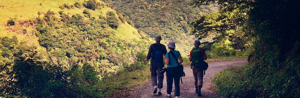
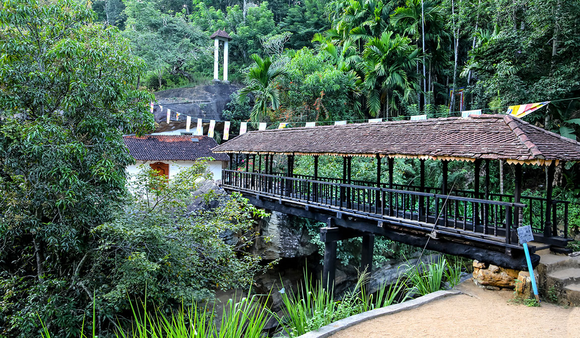
The Pekoe trail is a 308.5km trekking trail that travels through the central hills of Sri Lanka. The Pekoe Trail starting point is Hanthana. The trail runs through the tea plantations and scenic slopes, Bogawantalawa, remote village of Dayagama, Horton Plains, Udaweriya, Haputale, Lipton Seat, and Ella, Demodara, Hali-Ela To Ettampitiya, Kandapola, then all the way to Nuwara Eliya.
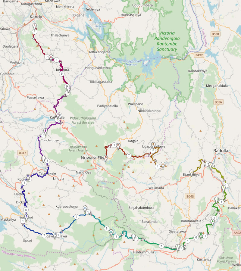
The trail that is about 308.5km had been divided into 22 stages. Each section is about 12km and runs through the well-known areas from Kandy to Nuwara Eliya.
The path runs through tarred roads and overgrown cart-tracks as in quarry paths, village roads. These roads were built during the British colonial time to transport tea from the vast estates to factories. Some of these routes are less touristic and with barely visible footpath that tea pluckers use as shortcuts through tea estates and forests.
Even though 22 treks through tea plantations sounds monotonous it is the essence of the walking in the Pekoe Trail. Each stage of the Pekoe Trail starts from a small town and it runs through the tea estates that spreads to the zenith. Some of the stages of The Pekoe Trail will carry you through dense forests patches with tall trees and eucalyptus forests. Each and every stage of the Pekoe Trail offers you breathtaking views and time to time you will come across the Buddhist Temples, shrines and hermitages.
When you travel across the Pekoe Trail you will not meet anyone for hours. The most sounds you will hear will be sounds of gushing waterfalls babbling birds and the crying of serpent eagles that flies high in the sky. Sometimes you will hear faint sounds of temple bells and chimes from Hindu shrines that are built in the middle of the tea estates.
For the time being only the Pekoe Trail stage one is opened for the public but in near future other 21 routes will be opened for the public and will be mapped out and most of them will be able to be walked.
Things to consider planning your Pekoe tour
Hiking Apps for the Pekoe Trail
Whether you hike, bike, run, or walk, a good hiking app is your companion and guide to the outdoors. A good app provides detailed reviews and inspiration from a community of trail-goers like you.
There is no comprehensive review or comparison between the various hiking apps. For most hikers on the Pekoe Trail there are worthy hiking apps specifically designed for the Pekoe Trail by a few apps providers listed below.
If you are a more advanced Pekoe hiker who like to explore or go off the beaten path, you need a fittingly good positioning system. Trekkers look for an advanced Global Positioning System or a GPS app which can serve the purpose. Visit the providers online and see if the apps available are what you are looking for.
Terrain
Try and collect newest available information about each and every stage of the trek. Take terrain, distance and accommodation into consideration before embarking on trekking each stage, see if you can easily arrange a one day hike, two day hike or even more for the selected area.
Weather
You can do the Pekoe trekking throughout the year. From May to June and from September to December the surrounding hills get a heavy rainfall, though the amount of rainfall does not mean that one cannot trek during these months.
During the rain the leeches come out and they are ready to cling on to anyone who passes them. Purple Turtle Leech Socks should be worn like a second pair of socks inside your boots and they pull right up over your trousers and above your knees which can then be secured with a toggle and elastic draw cord both above and below your knees, thereby creating a continuous leech proof barrier. Various methods of leech removal are utilized including salt, saline, vinegar, turpentine, alcohol, soap and heat.
Pick the right trail for your trekking
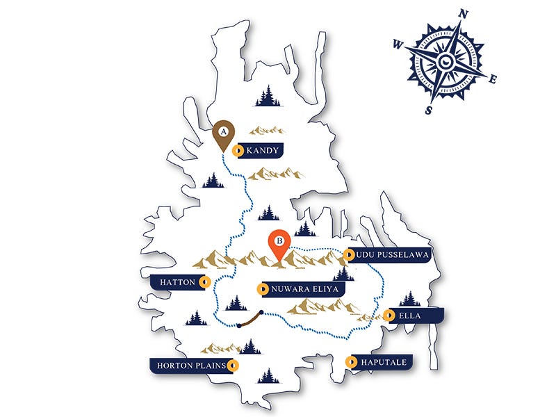
There are main bases in the hills that give the trekker multiple trails to select from for you to enter the Pekoe trail. Kandy is an excellent base and it provides two trekking trails stage1 and stage2 to choose from.
There are three trekking trails that are close to and can be chosen from Nuwara Eliya and there are five similar trails available from Haputale and Ella.
From Kandy you begin the first stage from Hantana To Galaha – 12.8 km, and the second stage from Galaha To Loolkandura (Loolecondera) – 14.7 km.
If you are visiting Kandy it is worth getting into the Pekoe trail while you are there. Start exploring both stage1 and stage2, together or separately, making Kandy as your base. Kandy is one of Sri Lanka’s main tourist destination and a popular base among the trekkers. Kandy provides good accommodation and there is a good bus service between Kandy, Galaha, Deltota and Loolkandura. Trek stage1 to Galaha and take a bus back to Kandy. Next day take an early bus to Galaha and trek stage2 to Loolkandura. Take a ride back to Kandy from the buses coming from Loolkandura or Hewaheta.

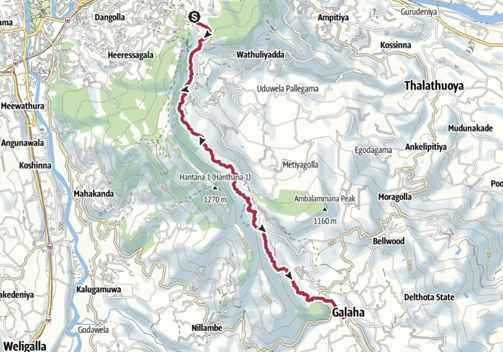
Pekoe Trail stage 1 from Hantana to Galaha
The Pekoe Trail stage 1 starts at the Ceylon Tea Museum on the Hantana Estate. The stage can be compassed on foot but not yet fully signposted. Heed local advice when available.
The Pekoe Trail follows the concrete path up towards the hotel W15 and the Hill Country Sport Shooting Club. The elevation gain is very gentle. At the 2.4 km point, there is a track that peels off to the left towards W15. At the 3.1 km point you’ve arrived at the Sugarcane Quarantine center.
Keep going on the track until the concrete gives way to gravel. At the 5.2 km point, there is a trail that peels off to the right towards a small stupa up in the mountain. This is a meditation center and avoid contact so as not to disturb.
At the 5.7 km point, you reach the highest elevation point at 1,067 meters and the total elevation gain is only 458 meters. The views on the way back towards Kandy are spectacular. On a clear day, you will see the Victoria Reservoir and the entire Knuckles Range to your left. It is impressive to realize the distance covered already. From here it’s all downhill until we cross the river 1 km away from Galaha.
Steven Spielberg filmed the ‘Temple of Doom’ in this area with Harrison Ford acting as an eccentric archaeologist.
On your descent toward Galaha watch out for a statue of Buddha on top of a rock. At the 10 km point, you walk through a fabulous forest with enormous trees. The crossing of the bridge at the 10.8 km point is the lowest point in the trail at an elevation of 754m. Head for Galaha Road and you have reached the end of this stage of the trail coming to Galaha’s Post Office which is only 900 meters away.
| Distance | Duration | Ascent | Descent | Highest pt | Lowest pt |
|---|---|---|---|---|---|
| 12.8 km | 4:00 h | 344 m | 300 m | 1,066 m | 765 m |
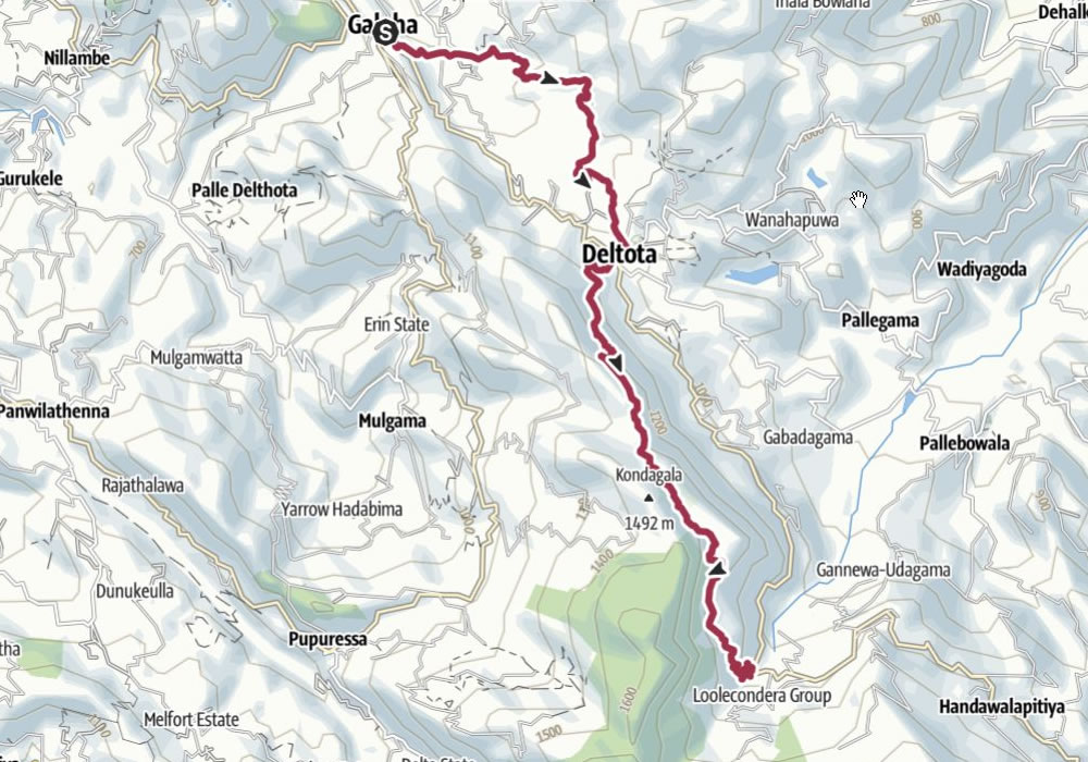
Pekoe Trail stage 2 from Galaha to Loolkandura
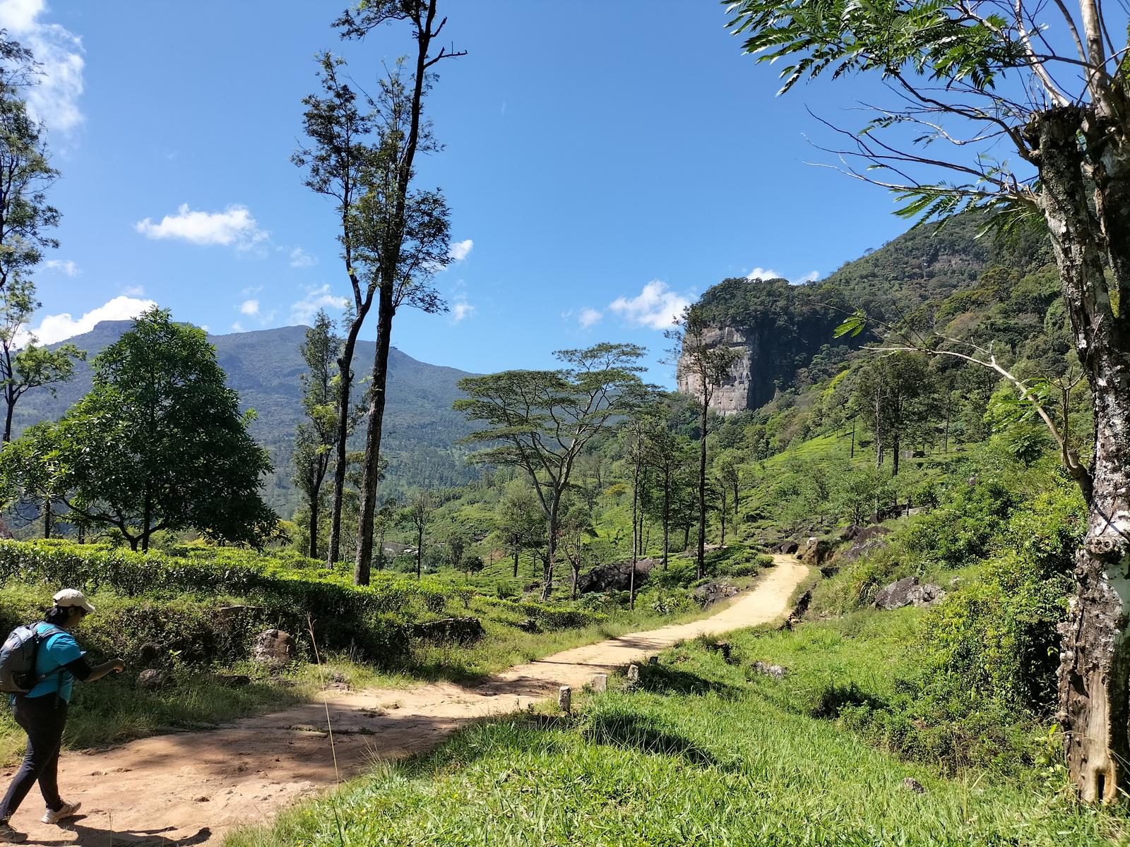
The Pekoe Trail stage 2 starts from Galaha. The walk from here to Loolkandura can be divided into two distinct parts. The first section takes you from Galaha to Deltota and the second from Deltota to Loolkandura. The current stage can be negotiated on foot but the route is not yet fully signposted. Heed local advice when available.
Galaha to Deltota is a short and rewarding hike. The first kilometer is on the road brings you to Galaha General Hospital. Leave the main road and head into the Deltota Estate and the path through the Deltota Estate is beautiful.
You are ascending a rather steep section of the path next, do look back, the views of the Hantana Estate and the mountains behind are stunning.
Head for Deltota town, there are lots of twists and turns, ask the locals for their advice.
Deltota is a typical hill country town with a lively market. The market is well worth stopping at.
Leave Deltota along the Galaha main road for 50 meters, take a steep road up to the left. At the 8.3 km point, the trail joins an old tea estate road and then zig-zags all the way up the mountain.
As the elevation gains the views get better and better. At the 9.3 km point, close to the top, the track levels out.
At the 9.7 km point, you come to an abandoned village, shortly after which you cross a small river. The track thins out here for about 300 meters. At the 10.5 km point, the small path turns into a wide tea track as you enter the higher divisions of the Loolkandura Estate.
The Loolecondera estate was the first tea plantation estate in Sri Lanka (Ceylon) started in 1867 by Scotsman James Taylor. James Taylor started in 1860 the plantation of tea within 19 acres (77,000 m2) of land in Loolecondera and it grew rapidly. In 1872, he started a tea factory with his latest invention of the tea leaves cutting machine. He spent most of his life in Loolecondera until his death in 1892. The authorities of Sri Lanka built a museum at Loolecondera in 1992 to commemorate him.
Loolecondera is a corruption into British English of the native name “Lool kandura” (ලූල් කඳුර in Sinhala). Loolkandura means “the stream full of loola fish” (Channa striata). It looks as eels. Loola Fish is a bony fish with endoskeleton ribcage, grows up to a meter in length. It is a snakehead murrel and generally referred simply as mudfish.
On this beautiful walk section, you can see the original cottage set up by James Taylor. This is an important milestone of the Pekoe Trail. James Taylor’s cottage is a short walk up the track you will come across on your right. Kondagala is the rock located just behind the JT cottage. The foot path to the rock starts at the Right corner of the JT cottage. There is a 300 meters hike to reach the top. The James Taylors seat is located little away from the JT cottage. It’s the place used by James Taylor to plan the tea plantation across the the Loolkandura valley.
It’s a slow and easy descent from here to the road below through some of the most beautiful tea bushes. The massive rock formation and the dense high-elevation rain forest in front of you, as you descend, are breathtaking.
The end of the stage is marked by a bridge and a Hindu shrine. Just before you reach the end you will see a small building on your right, an information center set up for travelers with clean toilets.
| Distance | Duration | Ascent | Descent | Highest pt | Lowest pt |
|---|---|---|---|---|---|
| 14.7 km | 5:05 h | 636 m | 347 m | 1,403 m | 793 m |
Reference: The Pekoe Trail Srilanka
Reference: Outdooractive
Reference: Wikiloc
Stages 3 to 22
Pekoe Trail stage 3 from Loolkandura to Tawalantenna
The 3rd stage of The Pekoe Trail begins at the small bridge over the Ma Oya on the Loolkandura Estate and ends at Tawalantenne – 17.8 km.
Pekoe Trail stage 4 from Tawalantenna to Pundaluoya
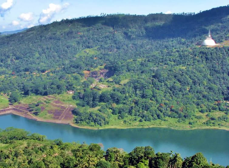
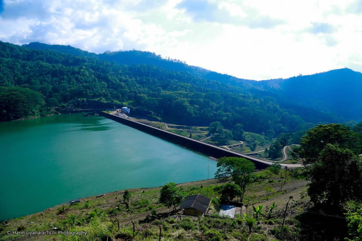
The 4th stage of the Pekoe Trail runs from Tawalantenne To Pundaluoya. On your ascent you’re gifted with glorious views of the Kotmale Dam, a large hydroelectric and irrigation dam, the second largest hydroelectric power station in Sri Lanka. The construction began in August 1979 and completed in February 1985. The dam forms the Kotmale Reservoir.
This is a part of the country steeped in legend. Its inaccessible terrain around Pussellawa and Kotmale was used by ancient kings of Gampola Kingdom to hide from enemies, the Sinhala prince Dutugamunu to take refuge to escape the wrath of his father, King Kavantissa, and by the Kandyan Kings to hide the sacred tooth relic during periods of political instability, the last occasion being during the British occupation in 1815.
The stupa you see at the far end of the lake is called the Kotmale Mahaweli Maha Seya, an 84 m high stupa, with a 61 m diameter. It serves as a reminder of the eighteen shrines/temples that were submerged with the construction of the Kotmale reservoir. – 14.1 km.
Pekoe Trail stage 5 from Pundaluoya to Watagoda
The 5th stage starts just before Pundaloya Town and proceeds to Watagoda. You can make your way into the true heart of the tea country of historical Dimbula which is, in fact, one of the earliest districts to be planted.- 14.1 km.
Pekoe Trail stage 6 from Watagoda to Kotagala
The Pekoe Trail stage 6 runs from Watagoda To Kotagala. At the 5.6 km point, you cross the railway line and walk along the main road towards Thalawakele town.
Cross the bridge to enter the town of Thalawakelle at an altitude of 1,198 meters and at 180C. You’re in the center of the Dimbula tea planting district which is the largest growing tea area in Sri Lanka.
Once you leave the hive of activity of Thalawakele behind the trail is delightful. This part feels like a fairy tale, a bit like “The Shire” in Lord of the Rings or the Cotswold Way in England.
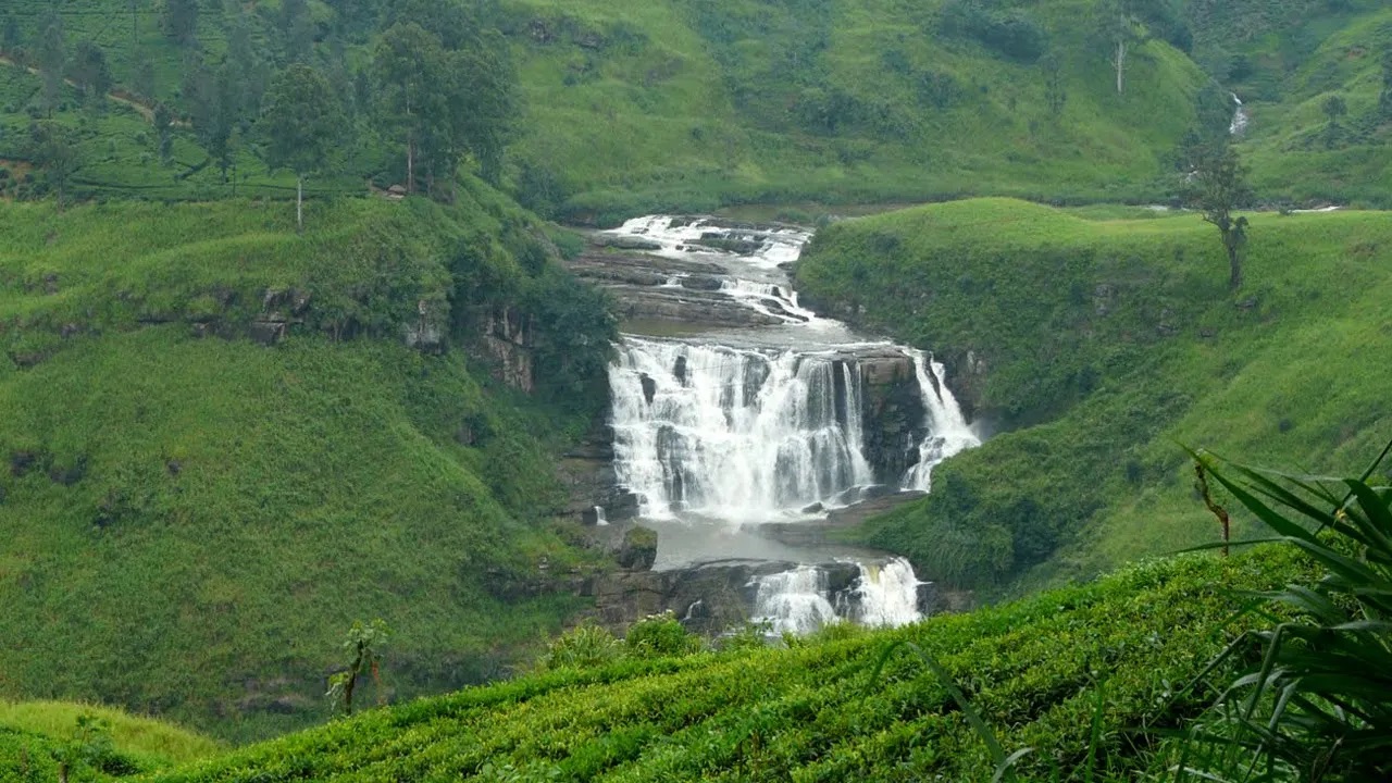
The first 1.5 km is a mild ascent and then a mild descent until you reach the St Claire Tea Factory – boasting its own train station. You might like to stop here to visit a tea factory and enjoy a cup of fresh tea.
On this trail you will come across the beautiful St Claire waterfall. St. Clair’s Falls is one of the widest waterfalls in Sri Lanka and is commonly known as the “Little Niagara of Sri Lanka” – 14.8 km.
Pekoe Trail stage 7 from Kotagala to Norwood (by-pass Hatton)
The stage 7 starts in the town of Kotagala and and runs straight to Norwood, by passing Hatton. You will see the Castlereagh Reservoir in the Bogawantalawa Valley, home to some of the best brews in Sri Lanka. – 16.3 km.
Pekoe Trail stage 8 from Norwood to Bogawantalawa
The stage 8 of the Pekoe Trail starts from Norwood and ends in Bogawantalawa. The Bogawantalawa Valley is known as ‘the Golden Valley of Tea’. Considered to be one of the most beautiful tea-growing areas in the country, this scenic valley overlooks mist-shrouded rolling hills and the mirror-still, picturesque Castlereagh lake. You are in Maskeliya which is one of the most beautiful valleys in the tea country, home to Sri Pada or Adam’s Peak, one of Sri Lanka’s most important sacred sites. The enshrined footprint at the summit is considered important to all religions as it is seen to be the impression of Buddha – 15.4 km.
Pekoe Trail stage 9 from Bogawantalawa to Dayagama
The Pekoe Trail stage 9 runs from Bogawantalawa To Dayagama. Dayagama is one of the most remote villages in the tea country. Dayagama lies at the far end of the Agarapatana Valley. Agarapatna Valley, one of the most remote and inaccessible valleys in the Tea Country. The Agara waterfall is located here. – 16.5 km.
Pekoe Trail stage 10 from Dayagama to Horton Plains


The Pekoe Trail stage 10 starts at Dayagama, a remote village in the tea country and takes you to Horton Plains. This is a physically and mentally demanding, and also logistically challenging trailing sector. You enter Horton Plains through the west gate. Farr Inn, the old hunting lodge for high-ranking British colonial officials is now turned into a visitor center. It is situated next to the car park from which almost all visitors start the walk to World’s End. You are at the highest point of the entire Pekoe Trail at an elevation of 2170 meters. The Great World’s End drop at Horton Plains is close to the Farr Inn. – 14.9 km.
Pekoe Trail stage 11 from Horton Plains to Udaweriya
The Pekoe Trail stage 11 trekking will take you from Horton Plains To Udaweriya. You will descend along the the Devil’s Staircase, the steepest downward descent of The Pekoe Trail.
The Devil’s Staircase is another popular trekker’s route and it starts from Kalupahana Junction on the Balangoda-Haputale A4 main road and ascends 3600 ft (1100 m) in less than 12 km to make it to the Ohiya-Horton Plains road, and from there to the Horton Plains National Park in 14 km. The Devil’s Staircase trekkers go past the Bambarakanda Falls, the highest waterfall in Sri Lanka. Close to Bambarakanda Falls, hidden in the hills is Lanka Ella falls, a cool, calm and beautiful place to relax. King Ravana chose the Lanka Ella visits frequently for a rest in this tranquilizing heaven. The Wangedigala mountain top is a popular camping site among the hikers today. Wangedigala can be reached off the Devil’s Staircase. King Ravana kept a lookout detachment on the top of the Wangedigala mountain and made observation visits on his Dandu Monara.
The Pekoe Trail covers only the top section of the Devil’s Staircase – from the point at which the track meets the Ohiya-Horton Plains road to a small village from where a trail cuts across the mountain around and over to the Udaweriya Valley. The views are truly breath-taking, all the way down and as you semi-circle around the mountain. On a clear day you can see Udawalawe National Park and beyond you might even see the coastline. – 13.1 km.
Pekoe Trail stage 12 from Udaweriya to Haputale
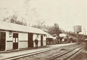
One of most exciting Pekoe Trails stage 12 extends from the remote Udaweriya Valley to Haputale. You will go past the Idalgashinna Train Station. The Station sits on a ridge, another incredible feat of engineering. Idalgashinna Railway Station is often deemed as the most picturesque railway station in Sri Lanka. The railway station is located on a hilltop separating the southern and eastern parts of Sri Lanka on the very border of two climatic zones. The views from the station are stunning: to the north, we look out towards Boralanda and Welimada and Udu Pussellawa, and to the south, we look out towards Beragala and down to the coast at Hambantota and the Udawalawa National Park.
The station is from the colonial era and was constructed in 1893 when the railway track was extended from Nanu Oya to Haputale. The station is also famous for having 14 tunnels between Ohiya and Idalgashinna, holding the record for the highest number of tunnels between two railway stations in Sri Lanka. – 17.1 km.
Pekoe Trail stage 13 from Haputale to St. Catherine
This very scenic route of stage 13 takes you from one of the major town Haputale to St. Catherine or Lipton Seat at 1875 meters. Surrounding the statue of Sir Thomas Lipton are the panoramic views of the mountains, and rivers are truly breath-taking. On a clear day, one can see as far as Udawalawe National Park and almost the entire Uva Province. – 14 km.
Pekoe Trail stage 14 from St. Catherine (Lipton Seat) to Makulella
The Pekoe Trail stage 14 runs from St. Catherine or Lipton Seat To Makulella. This stage is packed with all the spectacles of the trail; villages, places of worship, tea plantations, farms, historic bungalows, forested areas, and endless, never-ending breathtaking views of the mountains and valleys. You may see the Namunukula range and its nine peaks in front of you on a clear day. – 9.4 km.
Pekoe Trail stage 15 from Makulella to Ella
Stage 15 begins at Makulella and ends at Ella, a favourite tourist destination. Your trail will run close to the spectacular Ravana waterfall which was named after the legendary King Ravana who ruled over Sri Lanka from 2554 to 2517 BC. The story of King Ravana is written into the history of many countries, also described in the Ramayana which is believed to be merely semi-fiction. King Ravana flew to Ella in his Dandu Monara. Dandu Monara means ‘Wooden Peacock’ that flies. Dandu Monara is very similar to the modern-day helicopter but without the rotors. Ravana Falls is a popular sightseeing attraction today in Sri Lanka. Ella draws travelers to Sri Lanka’s highlands with its mountain forests, tea plantations, and relatively cool climate and is a very popular stop, start, or ending point along the trail.- 9.5 km.
Pekoe Trail stage 16 from Ella to Demodara

The Pekoe Trail stage 16 takes you from Ella To Demodara. You will cross the famous Nine Arches Bridge. This is a popular trail. You will be sure to meet a few other hikers on their way to or from the Nine Arches Bridge. The bridge is hauntingly beautiful and a major tourist attraction.
This exceptional Nine Arches Bridge is known as the bridge in the sky and is 80 feet high, and 300 feet long. The bridge was built during the colonial period in extremely challenging times of the 1919 Great War.
The construction of the bridge is generally attributed to a local Ceylonese builder, P. K. Appuhami, in consultation with British engineers. The chief designer and project manager of the ‘Upcountry Railway Line of Ceylon’ project was Devapura Jayasena (D. J.) Wimalasurendra, a distinguished Ceylonese engineer and inventor. The designer of the viaduct was Harold Cuthbert Marwood of Railway Construction Department of Ceylon Government Railway. The 1923 report “Construction of a Concrete Railway Viaduct in Ceylon”, published by the Engineering Association of Ceylon, has details of all the records including the plans and drawings.
Popular reports suggest that when construction work commenced on the bridge, the Great War began between the empires of Europe and the steel assigned for this site was reallocated to Britain’s War related projects at the battlefront. As a result, the work came to a standstill, leading the locals to build the bridge with stone bricks and cement, but without steel, except of course for the rails and pins securing them.
Next comes the intriguing feat of engineering at Demodara. Demodara railway station is well known for its spiral rail line at this location, popularly known as the ‘Demodara Loop’. This railway engineering marvel was born out of necessity, as during the construction of the extension of the line to Badulla, the steep ascent was found to be too much for the track and a novel approach was needed, so a 3000 foot (900 metre) rising loop was constructed in 1923.
During construction, the engineers found that elevation between the hills at Demodara was too much for the track to negotiate, with the maximum inclination allowed by the Ceylon Government Railway being one foot per 44 feet (1/44), an innovative track design had to be devised. Local folklore has it that one of the engineers, Devapura Jayasena Wimalasurendra, was inspired after observing a Kankany (Tamil word for supervisor) in a local tea estate undo his turban and re-tie it around his head.
To enter the station, trains have to perform a wide loop that goes through a tunnel under the station before circling back around, and climbing in a spiral to pull into the platform.
If you are doing this trail as a day trip from Ella you can ask your driver to pick you up at the Demodara Train Station or take a tuk-tuk back. Even better, take the train back to Ella crossing the Nine Arches Bridge on the way. – 8.8 km.
Pekoe Trail stage 17 from Demodara to Hali-Ela
The Pekoe Trail stage 17 runs from Demodara To Hali-Ela. Do not miss a visit to the amazing ancient Bogoda wooden bridge and the Buddhist temple situated at Hali-Ela. You can take a 30-minute Tuk-Tuk ride to Bogoda along the Hali-Ela Ketawala road.
The old wooden bridge which belongs to the Dambadeniya Kingdom Era (1220–1354 AD). This bridge is constructed to cross the Loggal Oya and it was on the old Badulla – Kandy road which had been used in the period of Kandyan Kingdom.
The Bogoda bridge is made entirely from wooden planks, which are said to have come from one tree. It is an exclusive construction as it has an 2.4 metres tall tiled roof structure for its entire span of nearly 15 metres length with a 1.5 metres breadth. Wooden fences of the bridge are decorated in various ancient designs and have been erected on either sides.
The structure of the bridge is standing on a huge tree trunk 11 metres in height. Jack fruit logs and Kumbuk logs were mainly used as the constructive material of the bridge. Furthermore, Kaluwara timber and Milla timber were used for the wooden decorations – 12.7 km.
Pekoe Trail stage 18 from Hali-Ela to Ettampitiya
The stage 18 of Pekoe Trail from Hali-Ela To Ettampitiya is a challenging uphill trail from start to end. The ascent starts at the town of Hali-Ela at an elevation of 730 meters, to the town of Ettampitiya at 1246 meters – 13.7 km.
Pekoe Trail stage 19 from Ettampitiya to Loonuwatta (Downside Estate)

The Pekoe Trail stage 19 goes from Ettampitiya to Loonuwatte through Downside Estate. Halfway the trail you will be crossing region’s most distinctive river the Uma Oya.
The Uma Oya is born at Pidurutalagala. The river eventually connects with the great Mahaweli, the longest river in Sri Lanka. The Uma Oya Hydropower Complex began as an irrigation and hydroelectric complex in the Uva province. Early assessments of project dates back to 1989. The project is now called Uma Oya Multipurpose Development Project (UOMDP). The UOMDP provides irrigation water to approximately 4,500 hectares of new land and 1,500 hectares of existing agricultural land in the Monaragala District. The areas of Badulla, Monaragala, and Hambantota will benefit from 39 million cubic meters (MCM) of water for drinking and industrial purposes.
The complex involved building a dam across Dalgolla Oya forming the Puhulpola reservoir, and channelling water over a 3,975 m (13,041 ft) link-tunnel to Mathatilla Oya, both of which are tributaries of the Uma Oya. At Mathatilla Oya, another dam is constructed to create the Diyaraba reservoir.
The water for the power generation is channeled from the Diyaraba resevoir at 145,000,000 m3 (5.1×10⁹ cu ft) of water per annum, via a 15,290 m (50,160 ft) headrace tunnel to the Uma Oya Underground Power Station consisting of a switchyard for transmission, where water from the turbines is then discharged to the Alikota Ara via a 3,335 m (10,942 ft) tailrace tunnel. The Alikota Ara Reservoir is built across a tributary of the Kirindi Oya. From there, it is further diverted to the Handapanagala Reservoir, which has been expanded threefold as part of the project.
The surge shaft connected to the headrace tunnel upstream is of diameter 3.7 m, steel-lined, and 141 m of height. The project necessitated the construction of a steel-lined deep pressure shaft of diameter 3.2 m and drop of 618 m to eject high pressure water on to turbines. A 750 meter water column may build up during surge creating a 73.5 barg release pressure at the pressure shaft let out. The successful completion of the Uma Oya hydroelectric power station is considered an unprecedented feat of engineering.
The underground powerhouse accommodates the turbines, a switch yard and connection to the transmission lines. The 122 MW Uma Oya Power Plant generates 290 GWh of energy annually to the National Grid.
Sri Lankan President Ranil Wickremesinghe and Iranian President Dr. Ebrahim Raisi jointly inaugurated the Uma Oya Multipurpose Development Project (UOMDP) on Wednesday, 24th of April 2024. – 18.9 km.
Pekoe Trail stage 20 from Loonuwatta (Downside Estate) to Uda Pussellawa
The Pekoe Trail stage 20 takes you from Loonuwatte to Uda Pussellawa. At the 4.5 km point, you arrive at the Sthripura Caves, an important cave network stepped in myth. According to folklore King Valagamba (who died in 77 BC) when in hiding had hidden 500 of his queens in this cave. The word “Sthri” is a Sanskrit term for woman and also in Sinhala. Sthri Pura means a place or city full of women. Sthripura, also spelled Isthripura, is a shortened form. Unique to this cave system is that unlike any other cave system in Sri Lanka it had a naturally occurring magnificent stone arch at the entrance.
The story is that about 250 years after the king’s time, having been found by some priests this cave like most other caves in the country had been converted into a Buddhist temple. There is a network of tunnels in the recesses of this cave which were designed for the king to escape. – 12.4 km.
Pekoe Trail stage 21 from Uda Pussellawa to Kandapola
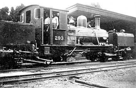
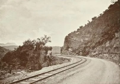
The 21st stage starts in Uda Pussellawa at an elevation of 1,275 meters and ends in Kandapola at an elevation of 1,936 meters. UPR or Uda Pussellawa Railways was the world’s most beautiful and highest narrow-gauge mountain railway line. It ran from Nanu Oya to Ragala via Nuwara Eliya. In 1895 the British governor Sir West Ridgeway was determined to build this mountain railway which was considered to be one of the toughest in the world due to the geography and toughness of the route. It opened in 1904 and provided freight and passenger transportation. Due to the second world war there was less priority given for the railway developments of Ceylon. On 2 August 1948 all services were withdrawn and the line was completely removed.
Kandapola railway station, which is 6316 feet (1,925 m) above sea level, was the sixth highest altitude railway station of the world. The mean line gradient in the climb from Nanu Oya to Ragala is 1 : 23. The climb from Brookside to Kandapola was even more difficult at 1 : 16. Also, there were bends with the radius of 80 ft.
Some ruins of these stations, bridges, sign boards and culverts can be seen even today when you are out there on your trail.
In a bid to attract more tourists to the destinations in the central region including Nuwara Eliya, the old railway track will be reconstructed from Nanu Oya to Uda Pussellawa via Nuwara Eliya to operate an electric train – 16.7 km.
Pekoe Trail stage 22 from Kandapola to Pedro Estate

This is the 22nd or the final stage of The Pekoe Trail. The trail starts at Kandapola town and the trail ends at the Pedro Estate Tea Factory. This is where your morning cup of tea originates. Pedro is a very well-known estate and a factory sitting proudly overlooking the surrounding countryside. It is located on a landscape with the blue sky as the background with green pastures of tea and water falls cascading, which is a sight never to be missed.
The Pedro Tea Estate is situated about 3.5 KM east of Nuwara Eliya and accessible by vehicle. The Pedro Tea Estate is very popular among visitors who come to Nuwara Eliya. Visitors can visit the Tea estate from morning up to 12.30 p.m. and again after 2.00 p.m. The factory remains closed between 12:30 PM to 2 PM. At Pedro Estate factory you will be shown the full process of how tea is manufactured and then graded and packed for export to all corners of the world, and you end the tour with a fresh cup of Pedro’s own Tea.
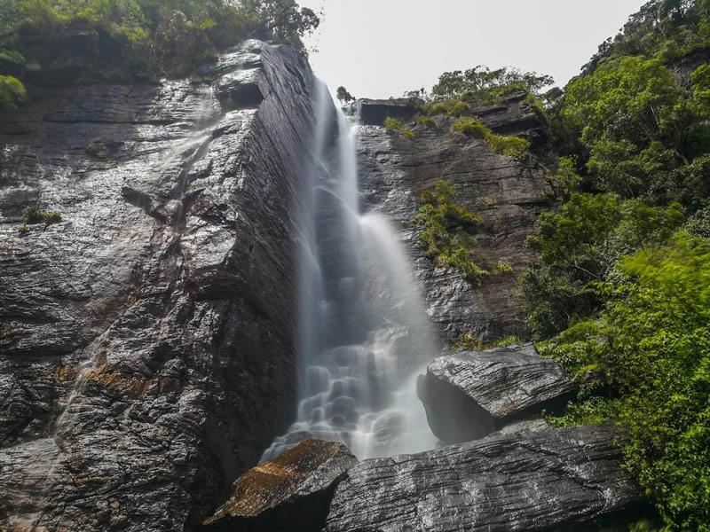
Just before you peel off from the main trail, at the 6.8 km mark, there is a trail that leads to Lover’s Leap, a popular day excursion from Colombo. The Lover’s Leap waterfalls is an impressive waterfall which is known for its romantic folklore. According to myth, Lover’s Leap Waterfall is said to derive its name from the tragic tale of a prince, who while hunting in the jungle, lost his way. A beautiful damsel rescued him from the local village, and the two became inseparable lovers. But the match was not to the liking of the Eliya King and Queen, so the two decided to leap to their deaths, so they could be united forever.
The iconic Pedro Tea Estate factory which is at 1894 m marks the end of the Pekoe Trail. The center of Nuwara Eliya town is a mere 3.5 km to the south. There is a bus stop, and there are also plenty of tuk-tuks to take you into town should you need local transport. – 10.8 km.
Reference: The Pekoe Trail Srilanka
Reference: Outdooractive
Reference: Wikiloc